Things to Do at Red Rock Canyon
Rock walls, a loop road and layers of history in the Mojave Desert
Overview and natural setting
Red Rock Canyon National Conservation Area is in Clark County, Nevada, in the United States, about 15 miles (24 km) west of Las Vegas. The Bureau of Land Management manages it as part of the National Landscape Conservation System, and it forms one of the easternmost parts of the Mojave Desert.
About 600 species of plants are known in the conservation area. Wild burros, rabbits and ground squirrels are familiar sights, and desert bighorn sheep are occasionally seen at higher elevations. The area is also a protected habitat for the desert tortoise.
The loop road, peaks and elevations
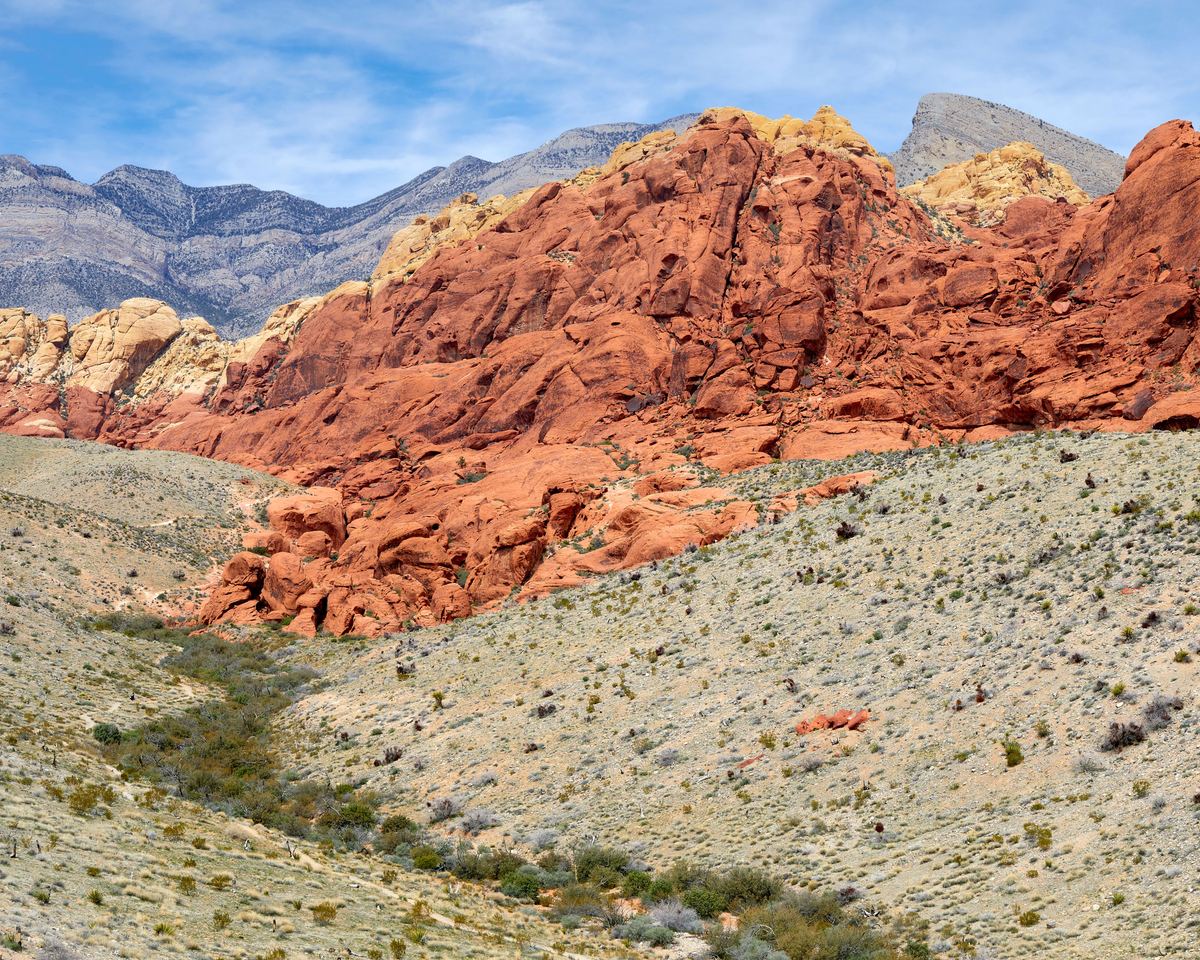
The scenic loop road is one-way and runs for 13 miles (21 km). Sandstone walls in the area are up to 3,000 feet (910 m) high. La Madre Mountain, at 8,154 feet (2,485 m), is the highest point in the conservation area, while the lowest elevation of the area is 3,600 to 4,500 feet (1,100 to 1,400 m).
| Feature | Measure |
|---|---|
| Scenic loop road (one-way) | 13 miles (21 km) |
| Sandstone walls | Up to 3,000 feet (910 m) high |
| La Madre Mountain, highest point | 8,154 feet (2,485 m) |
| Lowest elevation of the area | 3,600 to 4,500 feet (1,100 to 1,400 m) |
The geology behind the red rock
The Keystone Thrust Fault
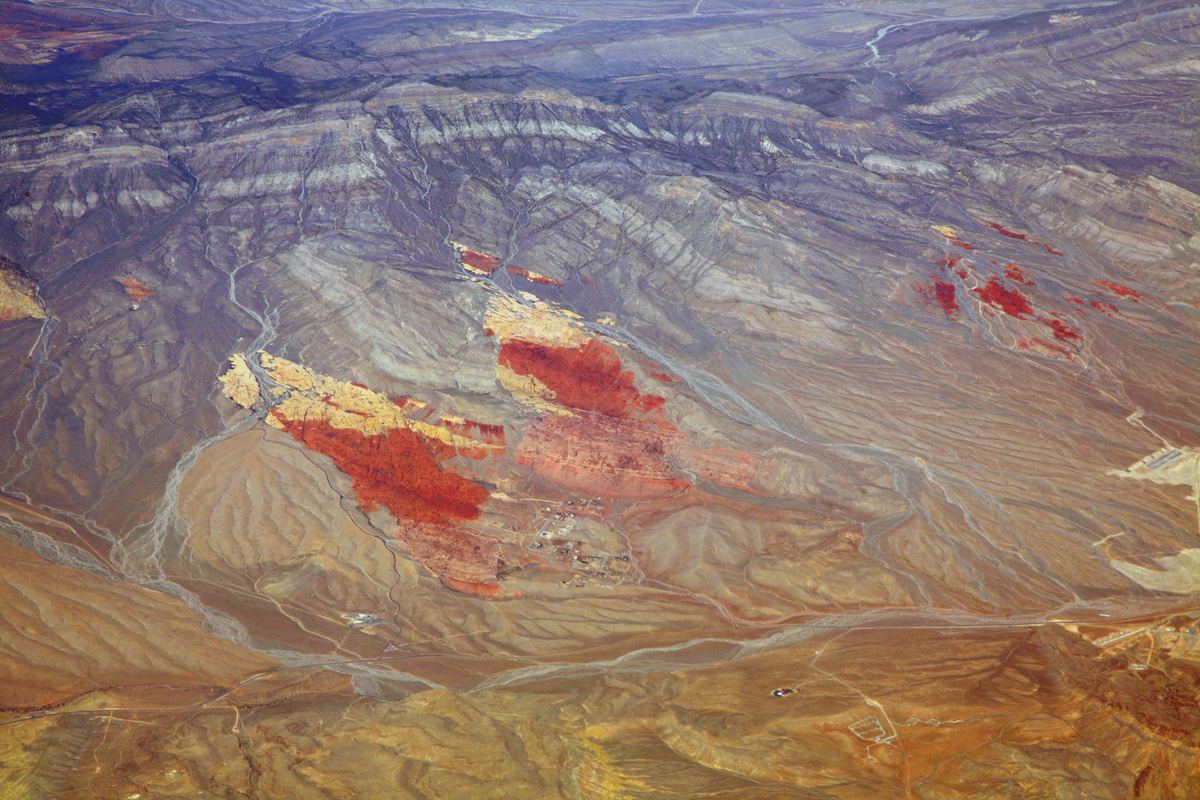
The Keystone Thrust Fault developed during the Laramide orogeny, around 66 million years ago. Along the fault, older gray rock was pushed over younger red rock, creating the varicolored landscape. The thrust is exposed for 13 miles (21 km) along the Red Rock escarpment, and the sandstone walls formed by thrust faults rise up to 3,000 feet (910 m).
Aztec Sandstone
Ancient sand dunes up to 0.5 miles (0.80 km) thick were lithified and became the Aztec Sandstone. The formation dates to the Early Jurassic and consists mostly of wind-blown sand. Primarily eolian in origin, it is exposed in the Mojave Desert of Arizona, California and Nevada.
Early peoples, the quarry and protection
Petroglyphs, pottery fragments and roasting pits remain in the area as evidence of early Native American activity.
In the early 20th century the Excelsior Company operated a small sandstone quarry near the northern area of the scenic loop. The quarry proved uneconomical and was shut down. In 1967 the Bureau of Land Management designated 10,000 acres as the Red Rock Recreation Lands.
- 1990: Legislation changed the status of the Red Rock Recreation Lands to a National Conservation Area.
- 1994: A second public law enlarged the national conservation area to 196,000 acres.
- 1998 and 2014: The Southern Nevada Public Land Management Act of 1998 added a smaller area, and the National Defense Authorization Act of 2014 added more than a thousand acres.
Guided tours and pet rules
Tours and activities
Questions about Red Rock Canyon
Frequently asked questions
Who manages Red Rock Canyon National Conservation Area?
The Bureau of Land Management manages it as part of the National Landscape Conservation System.
How long is the scenic loop road?
The one-way scenic loop road is 13 miles (21 km) long.
What is the highest point in the conservation area?
La Madre Mountain, at 8,154 feet (2,485 m), is the highest point.
How high are the sandstone walls?
The sandstone walls rise up to 3,000 feet (910 m).
When did the Keystone Thrust Fault develop?
It developed around 66 million years ago, during the Laramide orogeny.
What evidence of early Native American activity remains?
Petroglyphs, pottery fragments and roasting pits remain in the area.
How long can a pet leash be?
A leash may be no longer than 6 feet (2 m) in the conservation area.
Which animals live in the conservation area?
The area is a protected habitat for the desert tortoise, and wild burros, rabbits and ground squirrels are familiar sights. Desert bighorn sheep are occasionally seen at higher elevations.